Saturday 27th December 2025
Time to relax after the Christmas festivities with a sit down and a good book so especially for BusAndTrainUser blog readers here are three recommendations for your 2026 bookshelf.
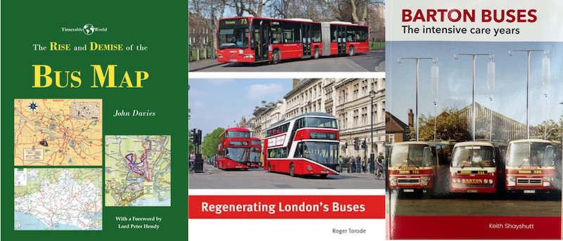
The Rise and Demise of the Bus Map
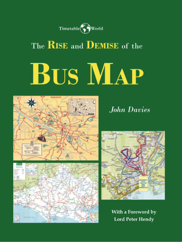
First up and hot off the press is this just published and truly wonderful book by map enthusiast John Davies.
As its title implies, John’s fantastic new book ‘The Rise and Demise of the Bus Map‘ charts how the production of bus maps developed hand in glove with the expansion of bus networks during the 20th Century when no self respecting bus company would exist without producing and distributing a cartographic masterpiece to help and encourage passengers to use its buses. Yet by the first decade of the 21st Century bus maps were becoming a scarcity in far too many locations leaving potential passengers mystified about where bus routes go.
John has amassed a huge collection of bus maps across the decades and uses examples from around the country over the last century, and more, to show the important role bus maps have played as well as identifying the characteristics that make for a successful bus map.
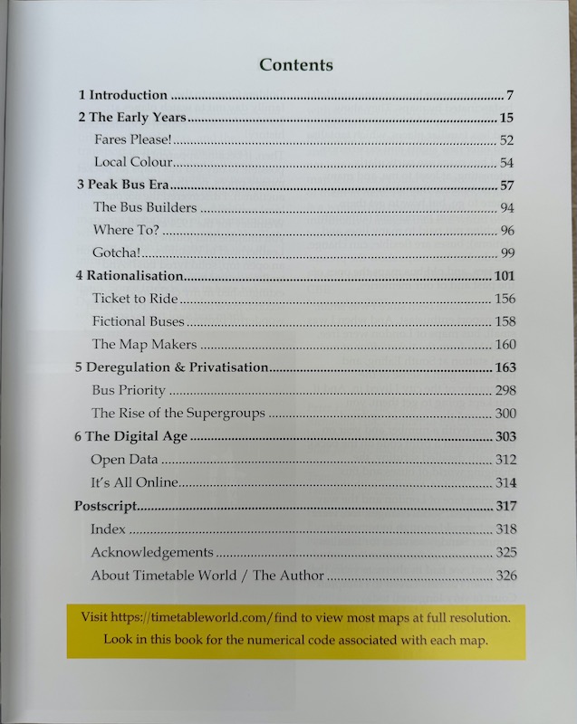
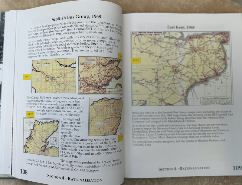
The book’s logically themed chapters take the reader on a journey through time from “The Early Years” up to 1948, through “Peak Bus Era” to 1967 followed by “Rationalisation” between 1968 and 1986 and “Deregulation and Privatisation” to 2010 and concluding with “The Digital Age – It’s all online”.
In each chapter John contextualises the development and production of bus maps within the structural and operational constraints and opportunities that could be found in the industry in each era with an insightful commentary to remind the reader what was happening at that time.
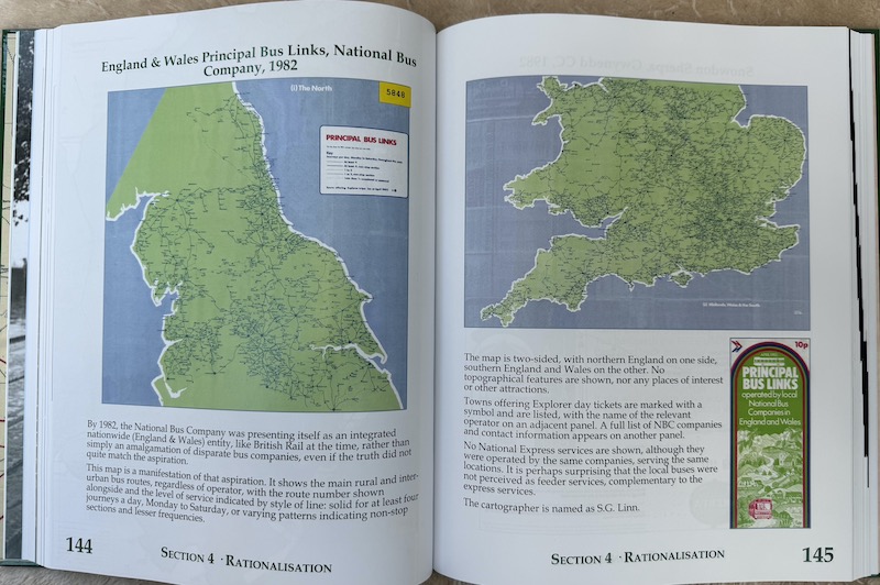
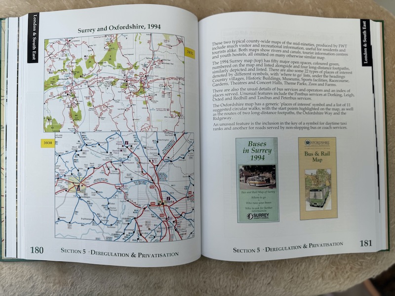
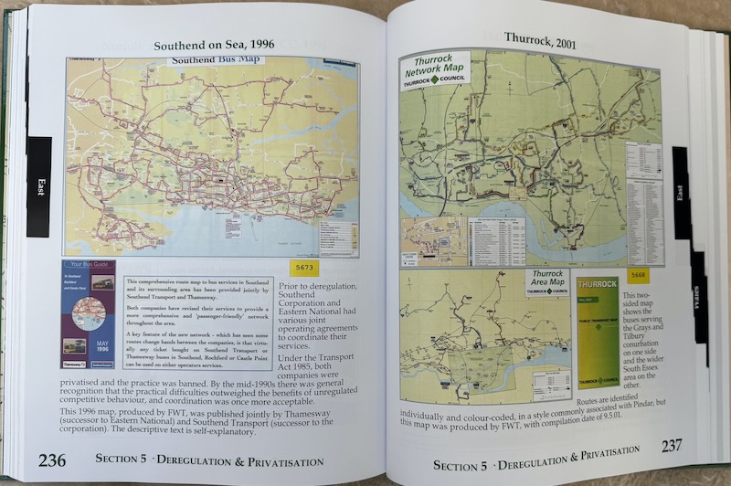
John has included 220 (yes, 220) images of historic bus, tram and trolleybus maps from all over the UK in this truly magnificent substantial 328 page hardback book.
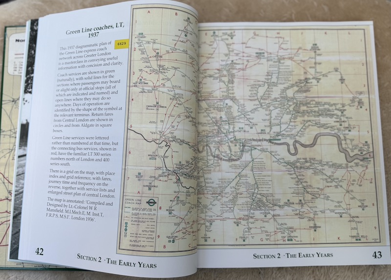
The development of London’s bus maps from trams and trolleybuses through to the post 1970 split with London Country is well documented which will particularly appeal to students of London Transport but every corner of the country is featured at some point in the book, not least those local authorities which took bus map production seriously at, and immediately after, deregulation in 1986.
Lord Hendy, a fellow bus map enthusiast, has written the Foreword to the book and rightly observes “I cannot imagine how anyone couldn’t be fascinated by maps. They show familiar places, which is comforting, and less familiar places, which tantalise and offer new sights and experiences”.
If only, I thought, as I read Peter’s heartfelt memories of his early years travelling on Red and Green Rovers using London’s excellent series of bus maps to guide him around the network, we could transport those experiences into contemporary times and all local authorities, Mayoral Combined Authorities (yes, including you, TfL) and bus companies throughout the country could see the value to be gained from producing a bus map, and did so. It’s no accident the book title refers to “… and Demise…” as sadly many areas are now devoid of a bus map.
John has produced a true cracker of a book which anyone who’s ever marvelled at a bus map needs in their collection. This truly is a “must buy” book. I can assure you, you won’t regret it.
The book retails at £40 and offers excellent value for the treasure trove of maps it contains but as a special deal exclusively for BusAndTrainUser blog readers John is kindly offering a 20% discount until 30th April 2026. Readers just need to enter the code ez77b3v2 at the online check out to save £8, making for a reduced sale price of £32.
‘The Rise and Demise of the Bus Map‘ can be purchased through the excellent volunteer led website Timetable World.com which is well worth an exploration in its own right. Details are available online at this link.
–Regenerating London’s Buses
Ten years on from its publication by Capital Transport in 2015, I’m delighted Roger Torode has followed up his seminal work ‘Privatising London’s Buses’ with this latest excellent follow on entitled ‘Regenerating London’s Buses’ covering the period from 2000 to 2015.
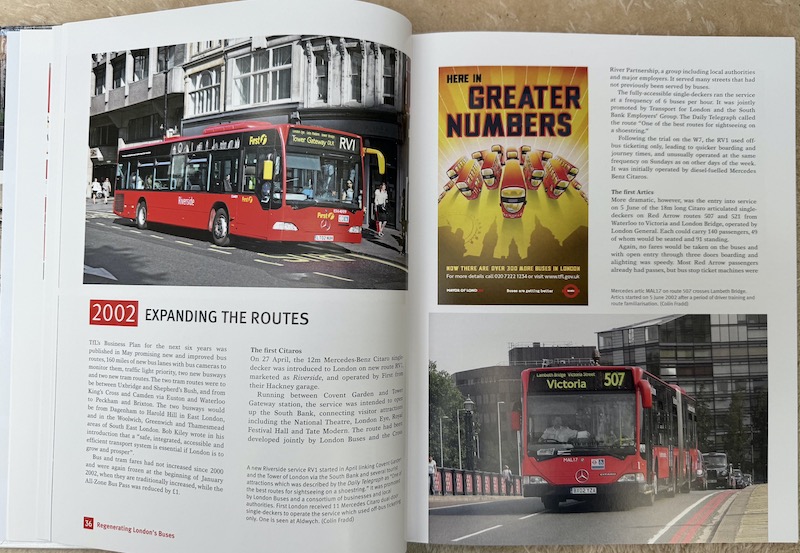
There’s no doubt this period was the golden era for London’s bus network with its Peak Vehicle Requirement increasing from 5,627 in 2000 to 8,032 in 2015 and passenger numbers increasing at the fastest rate on record since the formation of London Transport in 1933 (with the exception of recovery after World War 2).
As in his previous book, Roger has given the book’s extensive coverage of the myriad of developments and events during the 15 year period an authoritative edge having interviewed around 30 key people in senior roles at TfL and the companies operating London’s bus network for their reflections. These include Peter Hendy, Leon Daniels, David Brown, Mike Weston, Mark Yexley and John Trayner as well as Ken Livingstone, Boris Johnson and Steve Norris.
It was truly a stimulating time for London’s buses instigated by the devolution of powers from central Government to a new elected Mayor of London in control of the newly established Transport for London. The first Mayor, Ken Livingstone brought in radical policies including the Congestion Charge, a fares freeze, retention of conductors and Routemaster buses with bus service frequencies built up to levels not seen since the 1950s as well as extensive network development taking buses to roads never previously served.

The introduction of the flat fare, Oyster cards, and later, contactless bank cards as well as daily and weekly capping revolutionised payment systems and helped speed bus journeys by reducing dwell times at bus stops while the advent of articulated as well as low floor buses revolutionised boarding for those with accessibility needs.
Roger tells the story of these developments year by year across 18 chapters in the 192 page hardback book which highlights the impact of the change of Mayoralty half way through the period covered, in 2008, when Boris Johnson took over the reins from Ken Livingstone heralding new priorities including a reduction in the area covered by the Congestion Charge, increased road space allocated for cycling, the Cable Car, the proposed Garden Bridge and, of course, the New Bus for London project came to the fore.
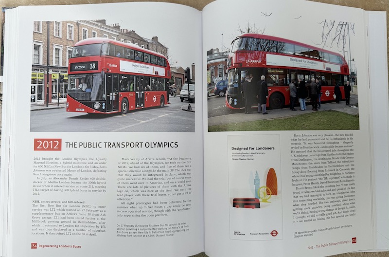
As you can see from these sample pages as befits a Capital Transport publication, the book is designed and produced to a high standard with numerous colour photographs illustrating the developments covered in each chapter.
A great read for anyone interested in the development of London’s buses.
It costs £35 and is available through Capital Transport’s website as well as the usual outlets.
Barton Buses The intensive care years
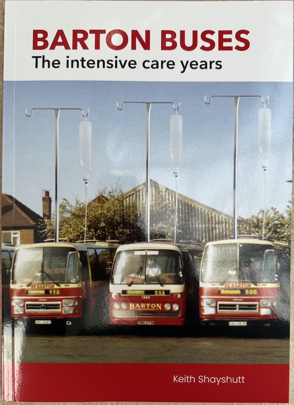
Keith Shayshutt has done it again. Another one of his deep dive forensic analysis books this time featuring the East Midlands based, fiercely independent, iconic bus company called Barton Buses.
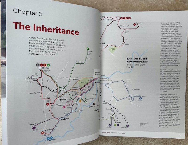
The story Keith tells in this latest self published book is of the three year period between 1989 and 1992 immediately after the company was bought by Wellglade, owners of Trent.
Keith quickly explains the reason for the subtitle ‘The intensive care years’ is because Barton was on the brink of collapse at the point of its sale to Wellglade and needed major surgery to keep it afloat.
And Keith should know as he was appointed Traffic Manager of the acquired business by Wellglade’s Directors with a mission to turn the company around.
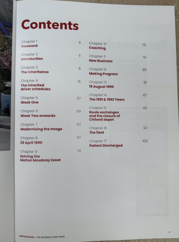
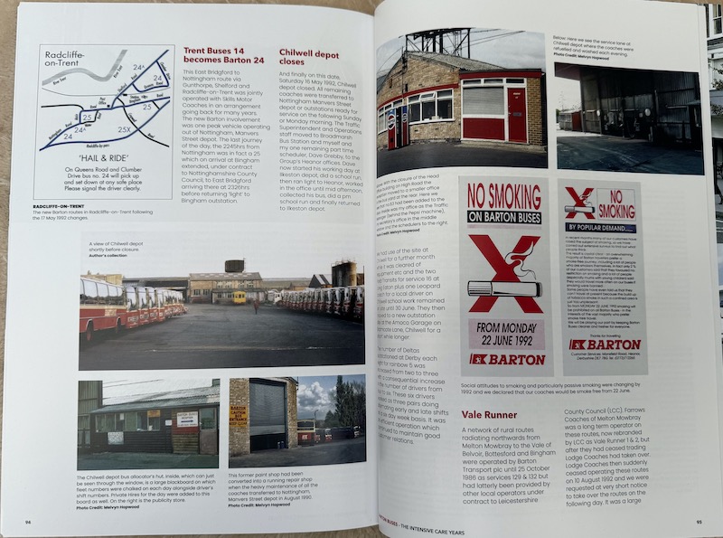
And that’s the period this book covers with Keith explaining across 17 brief very readable chapters, copiously illustrated over the book’s 108 pages, the series of actions taken during those three years to steady the ship and turn the company’s fortunes from financial disaster to dependable profitability.
It wouldn’t be a Keith Shayshutt publication without including very detailed information for schedules and timetable aficionados and this book is no exception with 40 pages devoted to working timetables and the schedules inherited at the takeover.
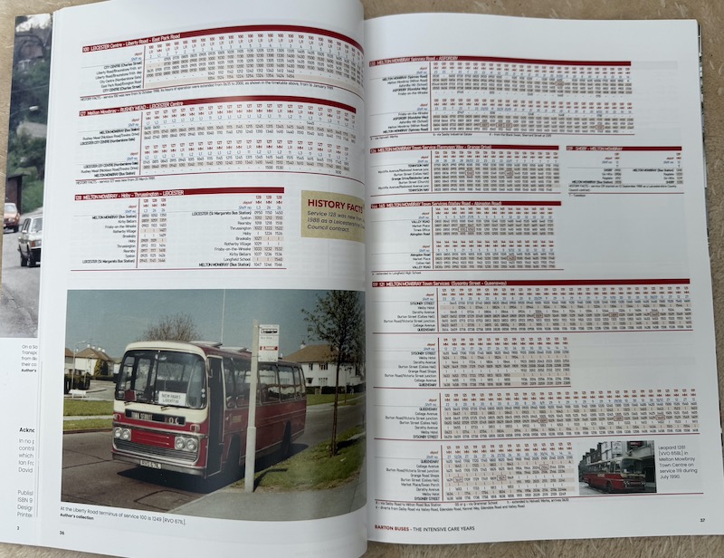
Barton deployed an inefficient system of drivers keeping the same vehicle for the whole of their shift as illustrated in the examples reproduced in the book which Keith very quickly changed to the more standard and efficient way of compiling vehicle workings prior to, and separate from, driver duties.
Keith also describes the turbulent changes in the network as a consequence of competition from neighbouring operators as well as the relentless reduction in overheads with administrative and engineering staff being progressively shared with Trent and Barton’s premises soon rationalised.
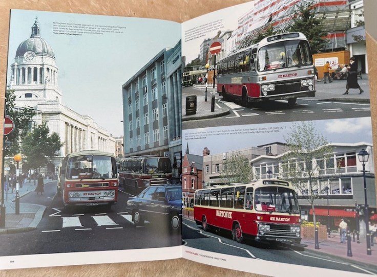
Keith manages to include around 100 colour photographs of vehicles in this 108 page book as well as many maps and images of leaflets, publicity and pertinent press cuttings and a fleet list.
If you’ve bought one of Keith’s previous books covering developments in Devon and Cornwall you’ll know what to expect and for £29.50 you won’t be disappointed. It’s available from the usual transport book outlets including MDS Books.
Roger French
Blogging timetable: 06:00 TThS

Many thanks for these, which all look to be very good and absorbing reads. Does John Davies address what I’ve always regarded as the greatest weakness of most bus-maps – the lack of indication of frequencies? It has always been frustrating to arrive at an unfamiliar town and find what looks like a good bus network, but discover after a bit that most services are only hourly or worse! It would be so easy to show e.g ‘at least every 7/8 mins as a thick line, eery 15 mins medium, at least hourly thin, and less than hourly as dotted.
Hoping that bus managers find a way to do this in 2026 – Happy New Year
LikeLiked by 1 person
At Best Impressions we have produced a number of easy to read maps that use different thicknesses of line to reflect different frequencies. If a map is too complex or too cluttered it can fail in its primary purpose, but in expert, experienced hands quite a lot is possible,
LikeLiked by 1 person
I totally agree Ray. I’m fortunate enough to live within the Go South Coast area & often refer to the excellent work you’ve undertaken on their behalf, from maps to bus stops! Keep up your efforts to convert even more bus companies to the art of effective marketing.
LikeLiked by 1 person
Having already bought the London and Barton books, I may now be persuaded to buy the bus map volume as well!
Hope you had a good Christmas, Roger.
Darryl in Dorset.
LikeLiked by 1 person
You can view some historical bus maps from Railwaymedia site too, mostly concentrate on the North West.
https://www.railwaymedia.co.uk/Timetables
LikeLike
Keith Shayshutt’s book is also available direct from the author on eBay. Just put in the title
LikeLike
Speaking of maps, Merseytravel used to publish great maps that were easy to read, but they changed the design a couple of years ago & they’re an abomination now, the Liverpool map doesn’t show Merseytravel tendered services like the 102 ecc which is farcical
SM
LikeLike
I look forward to “reading” the book on bus maps. I hope he mentions Brighton & Hoves evolution of maps in the deregulated era.
Pocket Bus Times was Brightons map complete with information on clock face headway departure times valid for a defined period.
Roads served were naturally red with the handful of infrequently served roads in a lighter shade.
This evolved into an excellent publication where the name of every bus stop was ingeniously shown in the space available.
High frequency routes branded as Metro with colour coding.
Fast forward to today’s map that doesn’t have bus stop names and as I write no paper version is available at One Stop Travel …. it’s online
Another item for “Dear Rupert” letter.
John Nicholas
Spending Christmas amongst the skittles.
LikeLike
GMPTE [now TFGM] maps have evolved over the years, they used to publish one map for the entire county [see Timetable World site who have some old GMPTE maps loaded] but now they publish a series of 12 regional maps, but the maps are large enough to include bus stop locations outside the Town/City Centers & include bus stop locations outside the GM area too.
SM
LikeLike
There is absolutely no excuse whatsoever for Companies and Authorities to abandon map production on the scale we have seen these last five years. They have seemingly followed each other like sheep, and the chant of “it’s all on the internet” frequently heard by those silly enough to risk ridicule by daring to ask, is false anyway. Very few Operators now produce any internet maps, and in the case of the few that still do, most are too large to be downloadable enough to be read! Or so crude showing just a series of lines of the main services that a five year old could draw.
One can more understand the lack of printed timetables, as by observation, even the archetypal “little old lady” pulls her smart phone out to check times and on deeply rural services the village “bush telegraph” is still alive and well. And with numerous changes occurring, not least of all AI “adjustments” now frequently made, a printed timetable is often obsolete before it has left the printers. But of course, this is no excuse where more stable networks exist, and a printed timetable with a map is always welcome.
But the penny has yet to drop with “those who know best”, and if they only realised a map of their routes may just produce a few more passengers wishing to explore their services, some may see sense.
But I won’t hold my breath.
Terence Uden
LikeLike
I’d like to know the comparison between those who publicise, and those who don’t.
Southampton: Bluestar had leaflets, a map and clear website … First did not. Which survived?
Oxford: OBC have all three … Stagecoach do not. My perception is that Stagecoach is quietly withering away … the latest OBC city booklet can’t include times of Stagecoach trips on joint services, as Stagecoach didn’t supply them.
Even Brighton seem to be getting back into leaflets with Ed Wills moving on … about time!
Timetables and maps don’t have to be fancy … just informative. Years ago, I ran a small local bus network with a timetable booklet. I reckoned, if the booklet produced one extra return passenger a day, the cost was recouped. It’s not much ….
LikeLiked by 1 person
An interesting analysis & not surprising that each of those companies providing excellent customer information are part of the Go Ahead Group.
You also refer to Ed Wills leaving Brighton & Hove. Hopefully his successor will re-instate the Red & Cream livery that made Brighton’s buses so recognisable & iconic.
LikeLike
I think the B&H livery is fresh and modern. Just what is needed to attract the younger generation onto buses. Red and cream was great too.
LikeLike
Many thanks for keeping us up to date with the world of buses (and trains) and for the review of the bus maps book. I shall certainly order one. Very best wishes for the New Year!
Anthony Holden
LikeLike
Thanks Tony; it’s my pleasure.
LikeLike
The topic on maps took me back to when I was a lad living in west London during the 1960s. My interest in LT buses & the desire to learn more about where they ran & from which garages, meant relying largely on LT bus maps, both Central & Country areas as well as Green Line, of course. These were available free from tube stations & provided everything needed to plan itineraries & to eventually, explore. They were also folded to a small size making them very easy to carry around. The advent of the internet has without doubt made life a lot easier in countless ways, yet, sometimes having printed information allied to a little imagination makes finding places just that little more interesting & enjoyable. Happy New Year Roger.
LikeLiked by 1 person
Very good Roger.
LikeLike
A little comment linking 2 of the books.
I had the pleasure of working with Keith at TrentBarton around 2000 creating thier first website.
They were the first bus company to use the brand new ‘Google maps’ to create the now familiar online sliding maps.
It was never advocated that these replace printed network maps but they have proved useful in the online age.
Shows how pioneering Keith and TrentBarton were.
As soon as we got these working for them we quickly rolled them out to Brighton & Hove’s website as well under Roger’s instruction!
LikeLiked by 1 person
Thank you for these reviews, and the bus maps book one in particular. I am going to need an extension to my book shelves but the discount will help towards that – it is very much appreciated indeed!
Steven Saunders
LikeLiked by 1 person
Most bus companies seem to think there passengers know when schools and colleges are on holiday even bus times cannot cop
LikeLike
Thank you Roger for these three reviews. The book about maps sounds really interesting. Happy New Year.
Greg
LikeLiked by 1 person
When I was a lad, a London bus map was an essential feature of my collection, to plan out my adventures, using a Red Rover to venture far and wide from home in Old Coulsdon. I would travel up to Hammersmith Broadway to experience trolleybuses on the Edgware Road and out to Fulwell and Hampton Court, without any difficulty.
I cannot imagine the difficulty that one would encounter nowadays in planning such adventures to distant places. Naturally, in my case, this led to a happy lifetime career in the public transport industry.
I rest my case.
Peter Murnaghan
LikeLiked by 2 people
A typo in the London review, a Congestion Change may have happened as a byproduct.
LikeLike
Thanks; now corrected.
LikeLike
Having now flicked through the pages of my copy of “The Rise and Demise of the Bus Map” I thought I should come back here to endorse Roger’s book review wholeheartedly, and also to thank John Davies for the tremendous effort he has made to produce such a outstanding and unique piece of work.
Steven Saunders
LikeLike
Received my copy of John Davies Rise and Demise of the Bus Map which lives up to expectations.
The chapter on map makers made for interesting reading on what has happened to FWT and Pindar.
One minor criticism of the index is all references to a place/area are shown, rather than identifying which ones relate to maps of the specified area and perhaps having those page numbers in bold.
Well worth the price.
John Nicholas
LikeLike